Meet FliteGrid: The Drone DePIN Built by Real Airspace Security Engineers
Most DePINs collect data that's useful. Environmental readings, traffic patterns, positioning data.
FliteGrid collects data the future airspace system literally cannot function without.
The company behind it, SkySafe, has spent nearly a decade defending some of the most sensitive locations in the U.S. from unauthorized drones. Universities, stadiums, airports, military installations. Their tech identifies drones in real time, reconstructs flight paths, and pinpoints operators on the ground. It's the system you deploy when failure isn't an option.

Now they're scaling that capability to the public through FliteGrid: a nationwide network of Remote ID sensors that will give the U.S. its first comprehensive dataset on low-altitude drone activity.
Here's why this matters:
- No one else has real drone activity data at scale. The FAA doesn't have it. Local law enforcement doesn't have it. Drone operators don’t have it. It simply doesn't exist yet.
- The entire UAS Traffic Management (UTM) framework depends on this data layer.
- SkySafe is positioned to become an FAA-designated Automated Data Service Provider (ADSP), feeding directly into the national drone traffic system.
- This is the ground layer for autonomous drone operations and airspace deconfliction.
- SkySafe already has a large base of revenue and customers in the airspace intelligence market.
- Massive contract opportunities that SkySafe is uniquely positioned for.
If the next decade belongs to physical AI and autonomous flight, this is the dataset everything will run on.
The Company Behind It
SkySafe isn't a crypto-native startup pivoting into hardware. They're a defense-grade airspace security company that's been operating since 2015.
- Backed by Andreessen Horowitz (a16z), Founder Collective, SVAngel, and others
- Raised nearly $50 million in funding
- CEO Grant Jordan served on the FAA's Aviation Rulemaking Committee for drone detection and mitigation, and is a board member of the Commercial Drone Alliance, the industry's primary policy voice
- As of 2025, SkySafe has tracked over 1 million drone flights through their existing sensor network
This team spent years in the field, working with federal agencies, building technology that works under real operational pressure, and helping shape the regulatory framework that governs drone operations today.

FliteGrid is the natural next step: take the detection layer that already protects critical infrastructure and scale it nationwide through community participation.
Why Now? The Regulatory and Cultural Moment
Three things converged to make FliteGrid both possible and necessary right now.
Drone Remote ID is now the law. As of March 2024, the FAA requires all drones operating in U.S. airspace to broadcast Remote ID. Think of it as a digital license plate. This applies to recreational pilots, commercial operators, and everyone in between. Remote ID creates a standardized signal that sensors can receive. But the FAA mandated the broadcast without building infrastructure to receive it at scale. There's no national network listening for these signals. Remote ID exists in theory, but the data isn't being collected. FliteGrid fills that gap.

The FAA's UTM vision requires this data. In May 2025, the FAA published its Drone Integration Concept of Operations, laying out how drones will operate in national airspace over the next decade. Central to that vision is UTM (UAS Traffic Management), a federated network that coordinates drone traffic the way ATC coordinates manned aircraft. UTM can't work without ground-truth data on where drones actually are. The FAA's framework explicitly calls for Automated Data Service Providers (ADSPs) to supply this information. SkySafe is building toward that designation, and FliteGrid is the infrastructure that makes nationwide coverage possible.
Public trust has eroded. You've seen the headlines. The New Jersey drone hysteria in late 2024, where unidentified drones sparked weeks of media coverage and public fear. Drones interfering with firefighting operations during the LA wildfires. Repeated incidents at airports, stadiums, and public events. The common thread? No one could say definitively what was in the sky. Law enforcement didn't have the data. The FAA didn't have the data. The public was left with speculation and fear. A nationwide detection network changes that equation entirely.
The Market Opportunity
The U.S. federal government is putting serious money behind drone detection.
In late 2025, the Department of Homeland Security announced a $1.5 billion multiple-award IDIQ contract for counter-drone capabilities across the agency. This is one of the largest drone security contracts ever issued, and it signals where federal priorities are heading.

DHS also launched a $500 million grant program to help state and local law enforcement deploy drone detection and mitigation systems, with the 2026 FIFA World Cup as the immediate catalyst. Eleven U.S. cities will host matches, and federal officials have made clear that drone security is a top priority for the event.
These contracts require detection infrastructure. Remote ID data is the foundation. The agencies issuing these contracts need to know what's in the sky before they can respond to threats.
SkySafe is already a validated vendor in this space, with existing contracts at DHS and selection for FAA testing programs. As FliteGrid scales, the network becomes increasingly valuable to exactly the customers writing these checks.
Understanding Remote ID
Remote ID is often described as "license plates for drones," but the reality is more complicated.
The broadcast includes:
- Drone location and altitude
- Operator location
- Unique identifier
Useful information, but receiving it at scale presents real technical challenges.
Remote ID protocol can broadcast over Bluetooth 4/5, Wi-Fi Beacon, and Wi-Fi NAN. A receiver needs to support all of them. Bluetooth-based broadcasts typically reach 300-500 meters under ideal conditions. Wi-Fi extends that somewhat, but you still need dense sensor coverage for meaningful visibility. And due to operating system limitations, many consumer devices simply can't participate in receiving this data.
Compliance is also inconsistent. When Remote ID requirements launched, SkySafe conducted one of the few independent analyses of major drone manufacturers and found that many were not actually compliant. Without a receiving network, there's no accountability mechanism.
FliteGrid sensors are purpose-built to receive all Remote ID protocols, feed that data into SkySafe's cloud platform, and create the accountability layer that's currently missing.
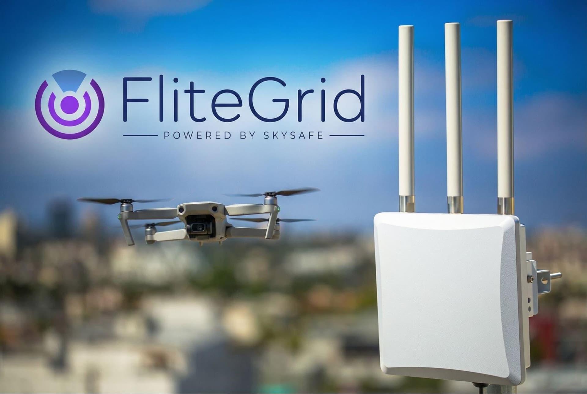
How FliteGrid Works
Each FliteGrid sensor is a compact, energy-efficient device designed for residential deployment. Rooftops, balconies, etc.
Once installed, the sensor:
- Listens for drone Remote ID broadcasts across all protocols
- Validates the data using cryptographic verification and proof-of-location
- Transmits flight information to SkySafe’s cloud infrastructure in real time
- Contributes to the national coverage map
Contributors can view drone activity detected by their sensor through the FliteGrid platform; the same interface used by airports and public safety agencies.

DePIN networks live or die on data integrity. FliteGrid addresses this through:
- Trusted hardware: Validated encryption keys that authenticate data origin
- Proof of location: Signed and encrypted GPS data that verifies sensor placement
- Cross-validation: Overlapping sensor coverage that detects anomalies and spoofing attempts
Future phases will add verification flights from drone service providers conducting normal, logged operations that confirm sensor coverage and accuracy.
The Coverage Model
FliteGrid uses an H3 hexagonal grid to map coverage, with each hex assigned a value based on the importance of the airspace it covers.

High-value airspace includes:
- Airports and heliports
- Stadiums and large event venues
- Prisons and detention facilities
- Military installations
- Critical infrastructure (power plants, water treatment, data centers)
- University campuses
- Border regions
- Emergency response zones
Sensors covering high-value hexes earn proportionally higher rewards. This reflects where drone activity data is most operationally valuable and where customers are willing to pay for coverage. Law enforcement agencies need visibility around detention facilities. Airport operators need awareness of their approach corridors. Federal agencies need monitoring along borders.
Hex values will adjust over time as the airspace system evolves, new restricted zones are designated, and coverage gaps are identified.
SkySafe in the Field
Abstract capabilities don't mean much without real-world validation. SkySafe has built their reputation through deployments where the stakes are highest.
Motorola Solutions Strategic Alliance. In April 2025, SkySafe announced a strategic partnership with Motorola Solutions, the global leader in public safety and communications. The partnership integrates SkySafe's drone detection directly into Motorola's CommandCentral Aware situational software, giving law enforcement and emergency responders unified visibility across radio communications, video surveillance, and airspace monitoring. A 911 dispatcher can now see drone activity in the same interface they use to coordinate patrol units and review security footage. For public safety agencies already running Motorola Solutions infrastructure, SkySafe becomes a natural extension of their existing operations.
U.S. Customs and Border Protection. SkySafe secured a contract with U.S. Customs and Border Protection to enhance drone detection capabilities along sensitive border regions. The deployment provides real-time visibility into drone activity in areas where unauthorized surveillance and smuggling operations pose ongoing threats.
FAA Detection and Mitigation Program. The FAA selected SkySafe for its UAS Detection and Mitigation Testing and Evaluation Program, validating the technology against federal standards for airport and critical infrastructure protection. This selection positions SkySafe as a trusted vendor for future FAA initiatives around airspace security.
University and Stadium Deployments. During a packed Big Ten football game at the University of Illinois, a rogue drone entered stadium airspace. SkySafe's system detected the signal, reconstructed the complete flight path, identified the operator's location, and provided the forensic record that allowed law enforcement to act. What previously required dozens of officers and substantial guesswork was resolved through a single platform. SkySafe's technology currently secures major university campuses, stadiums, critical infrastructure, airports, military installations, and emergency response operations across the country.
Timeline
- Q4 2025: U.S. sensor pre-orders open (first 1,000 receive bonus reward points)
- Q2 2026: Sensors ship to contributors
- Q3 2026: Network goes live; data sales to customers begin
- 2027: $FLITE token launch
- 2027: International expansion to Japan and EU
Japan and the EU have both implemented Remote ID requirements, creating parallel opportunities for network expansion as regulatory frameworks mature.
How to Participate

For U.S. participants, pre-orders are now open. The first 1,000 sensors receive bonus points that carry through to token launch. For Japan and the EU, sign up for early access at flitegrid.io to be notified when international pre-orders open.
You'll need:
- A location with clear sky visibility (rooftop, balcony, etc.)
- Standard power outlet
- Internet connection
No technical expertise required. Setup is designed to be straightforward. Install the sensor, connect it to the network, and start contributing.
The Bigger Picture
The next decade will see millions of drones operating in U.S. airspace. Delivery networks, infrastructure inspection, emergency response, agriculture, media, and applications we haven't imagined yet.
All of that depends on a coordination layer that doesn't exist today. The FAA has laid out the vision. The regulations are in place. The technology is proven. What's missing is the infrastructure to collect, validate, and distribute drone activity data at national scale.
FliteGrid is that infrastructure. And unlike most infrastructure projects, this one lets you participate directly. You can contribute coverage, earn rewards, and help build the data layer that autonomous airspace will run on.